Oxford Dinosaur Highway 2026: What the New Footprints Reveal
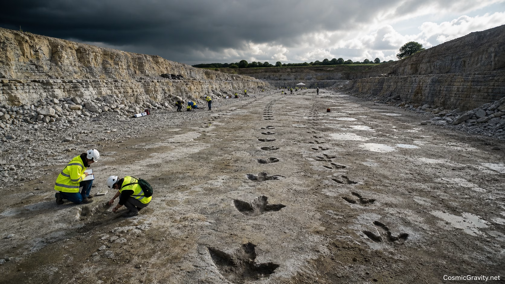
About 166 million years ago, enormous sauropods crossed a wet Jurassic landscape in what is now Oxfordshire. A large meat-eating dinosaur—probably a Megalosaurus—left a three-toed trail across the same ground. The mud hardened, was buried, and finally reappeared in a modern quarry as one of Britain’s most remarkable dinosaur trackway sites.
Researchers returned to the “Oxford Dinosaur Highway” in June 2026 to expose more of the surface and study how the tracks connect. Unlike an isolated footprint, a trackway records movement: direction, stride, pace and sometimes the interaction of several animals using the same route.
A footprint is a moment of behaviour
Bones tell us what an animal was built like. Tracks show what it did. The distance between successive prints can be used to estimate speed when combined with hip height. The orientation of multiple trails can reveal whether animals moved in a common direction or simply crossed the same patch at different times.
The 2026 work is especially valuable because quarrying offers a large, fresh surface. Every metre exposed can connect prints that previously looked unrelated.
Compare the trackmakers
Sauropod trail: broad, rounded impressions from heavy feet; long parallel trackways; the animal’s mass pressed deeply into soft sediment.
Theropod trail: narrower three-toed prints; a more bird-like foot shape; potentially made by a nine-metre predator.
What researchers test: stride length, depth, sediment deformation and whether two trails are truly contemporary.
Was this a dinosaur road?
The word “highway” is irresistible, but it should not be taken too literally. Parallel tracks might mark a shoreline, river margin or firm route through softer ground. They do not automatically prove a herd marched together.
To distinguish a shared journey from repeated use, palaeontologists examine overlap, preservation and the microscopic layers between prints. A thin film of sediment can mean minutes, a tide, a season or longer separated two trackmakers.
The Jurassic landscape beneath the quarry
The team also recovered clues from shells and other fossils. Brachiopods and bivalves help reconstruct a shallow marine environment changing over time. Dinosaurs may have been travelling across exposed carbonate mud close to lagoons or tidal flats.
That environmental work matters because a footprint without sediment context can be misleading. Water content changes the size and shape of a print; one footfall can create several concentric “ghost” impressions.
How the tracks are preserved digitally
Drone photography and photogrammetry allow thousands of overlapping images to become a measurable 3D surface. Researchers can revisit the model after the quarry face changes, compare print depth and share the site with specialists worldwide.
The digital record also gives the public a way to explore without walking across fragile tracks. A future interactive model could be as scientifically useful as it is spectacular.
Sources and further reading
latest video


news via inbox
Subscribe to our Cosmic newsletter to get notified when we have new articles.